The Parish
- Home
- The Project
- Photographic Archive
- Heritage Trail
- Oral History
- Church Project
- Mapping Project
- Documents Archive
- Merchandising
- Links

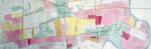
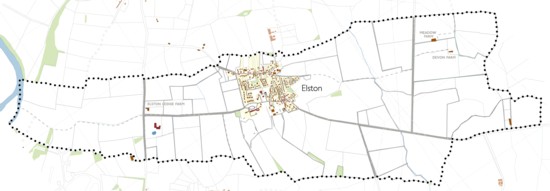 MAP OF THE PARISH OF ELSTON
The parish is broadly wedge shaped, 5.7kms long and 540m wide at its narrowest western point along the Trent and widening to 1.84kms at Cross Lane close to its eastern extremity at the River Devon. The area between the Trent and the A46 is 1.4kms long, bordering Syerston Airfield and Syerston Hall on the southwest and the Stoke battlefield on the northeast and widening to 900m where it abuts the A46. The greater part of the parish lies to the east of the A46 bordering East Stoke to the north, along the line of the Codder’s Dyke for much of the way, and on the south borders Syerston and Sibthorpe parishes.